Traditional USBL vs closely coupled INS + USBL solution

Underwater tracking systems are essential for safe and accurate subsea operations, whether you’re monitoring diver movements, guiding autonomous vehicles or conducting offshore surveys. Two widely used technologies in this space are Ultra Short Baseline (USBL) and Inertial Navigation Systems (INS).
Used on their own, each offers valuable capabilities. But when closely integrated, they create a more efficient, accurate and flexible solution, especially for short-term or vessel of opportunity deployments.
Let’s explore how and why a closely coupled INS + USBL system outperforms traditional configurations.
A quick guide to USBL’s
Ultra Short Baseline (USBL) systems have been used since the 1990s to track people, sensors, vehicles and structures underwater. They now play a vital role in aiding data collection and the safe navigation of divers and vehicles underwater, allowing surface teams to see where assets are located.
USBL systems use acoustics to communicate with a transponder beacon fitted to a target. The transponder beacon responds to the acoustics, and an element array inside the transceivers’ transducer measures the precise timing of the reply. It then calculates the Direction of Arrival (DOA) of the signal and the range, providing the position of the target relative to the transceiver.
Additional motion (AHRS / MRU / GYRO) and location referencing (GPS/GNSS) can translate the subsea position into a real-world position.
For a more detailed overview of USBL systems, see our previous articles ‘how do Ultra Short Baseline systems work?’ and ‘underwater tracking – how does it work?’.
Inertial navigation systems explained
An Inertial Navigation System (INS) is a collection of electronic devices that track and measure an object’s motion by combining data from multiple sensors and measurement devices.
At the core of an INS is an Inertial Measurement Unit (IMU) device. These devices utilise internal accelerometers and gyroscopes to measure linear acceleration and rotational velocity, helping to determine how an object has moved from its starting point across three or more axis. This is supported by data from GNSS devices, which utilise transmitted signals from a global network of satellites to determine the latitude, longitude and height of the device.
By processing this raw data through a Kalman filter, an INS can obtain accurate readings on an object’s attitude, position, orientation, linear velocity and angular rate. Even when outages or errors in GNSS data occur, a vehicle can continue to function and maintain reliable navigation.
For subsea operations, aiding from USBL positioning transponders and DVLs can help to maintain a vehicle’s navigation accuracy without needing to surface for GNSS positioning updates.
USBL with an integrated INS
Integrating a USBL system with an INS creates a powerful tracking and positioning solution that offers several advantages over the separate integration of heading (GYRO), GNSS and motion reference units (MRU). However, to understand the benefits, let’s delve into the common issues and disadvantages of a standalone USBL and the integration of other sensors.
Common challenges with traditional USBL setups
At applied acoustics, our technical support team has identified several common issues when interfacing USBL systems to obtain the best quality data that the transceiver is capable of gathering. Many performance issues stem from set-up and installation.
Common challenges include:
- Misalignment errors between external sensors and the acoustic reference
- Slow update rates in the transmission and reception of external data by the USBL system
- Inaccurate time synchronisation between systems
- Vibration and movement of the navigation pole and the uncompensated motion of the USBL
- Time-consuming calibration and set-up, referencing of all equipment to a Central Reference Point (CRP) and proofing of system performance and operation
There are also additional acoustic errors; however, these are still common across all USBL-based systems.
Installation challenges can vary from vessel to vessel and consume a significant amount of time in the configuration and set-up of a system. The average time to set-up a USBL system ready to gather data on a survey is 2-3 days. This not only adds to the cost of the survey but can also affect weather windows for gathering data and completing a job, increasing costs and reducing profitability. Deploying a beacon to perform acoustic calibration for interfacing external sensors, as well as the calibration, processing and validation of data, can take anywhere from half a day to a full day. It also requires additional equipment to deploy to the seafloor, and there is a risk of equipment loss or damage.
The case for a combined INS + USBL solution
A combined INS and USBL solution can:
- Halve set-up time
- Eliminate the need for acoustic calibration
- Enable faster contract completion
- Remove the complexity of measuring lever arms with multiple sensors
It’s important to note that a properly calibrated, synchronised and installed USBL system with external sensors will still perform just as well as a combined INS + USBL system and is often preferred for permanent installation on survey vessels.
When to use a combined system
A combined INS + USBL comes into its own for quick installation on vessels of opportunity around the globe, for short-term operations. It removes the ambiguity in calibration results and sensor integration. A combined system provides repeatable results, reduces costs and improves the speed and quality of data acquisition. It also provides a comprehensive single-survey solution, with INS and GNSS outputs available regardless of the USBL data. One piece of equipment can be used for a multitude of surveying methods.
The close coupling of INS and acoustics offers additional advantages, including high-speed and low-latency motion updates, which enhance the accuracy of acoustic position and mitigate issues with the motion of the transceiver underwater, allowing for occasional sensor dropout or error in position.
How do INS + USBL systems work in practice?
For Unexploded Ordnance (UXO) and diver positioning projects, global marine geophysical consultants and surveyors, SAND Geophysics, often used standard USBL systems.
However, they found that these devices weren’t delivering the level of accuracy their clients needed. They often demanded significant time and effort to calibrate and required manual handling, which increased risks and costs to clients while reducing their efficiency and flexibility.
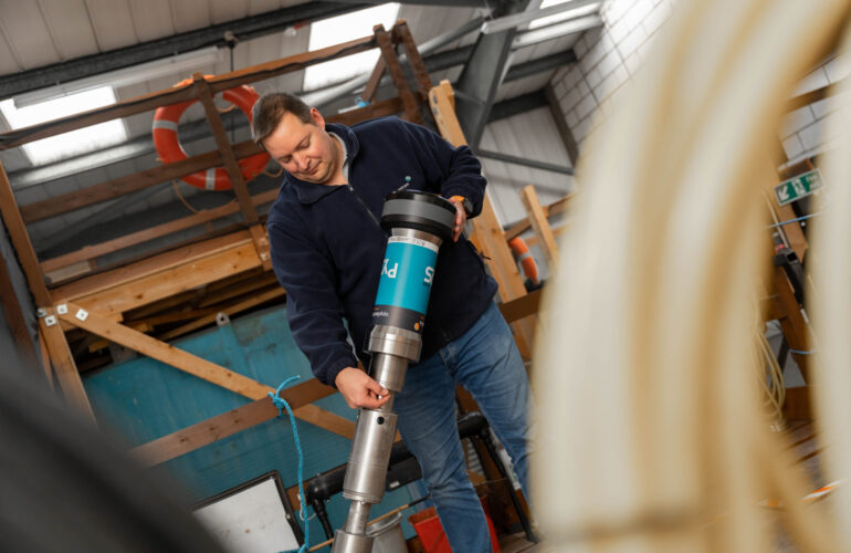
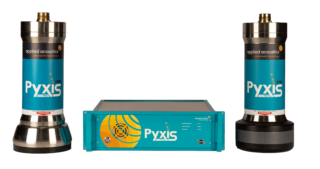
To improve their accuracy and speed up operations, the team switched to a Pyxis INS + USBL system. The result?
- Calibration time was reduced by two to three times
- Manual handling was minimised, improving safety
- Operational efficiency improved
This meant that SAND Geophysics could deliver higher-quality results for its customers more cost-effectively and with less risk. As Director James Matthews explained, “The decrease in calibration time for the Pyxis vs other USBL systems has increased our team’s performance and presented significant cost savings to our clients.”
To learn more about how the Pyxis system could transform your operations, please contact our experts today.


